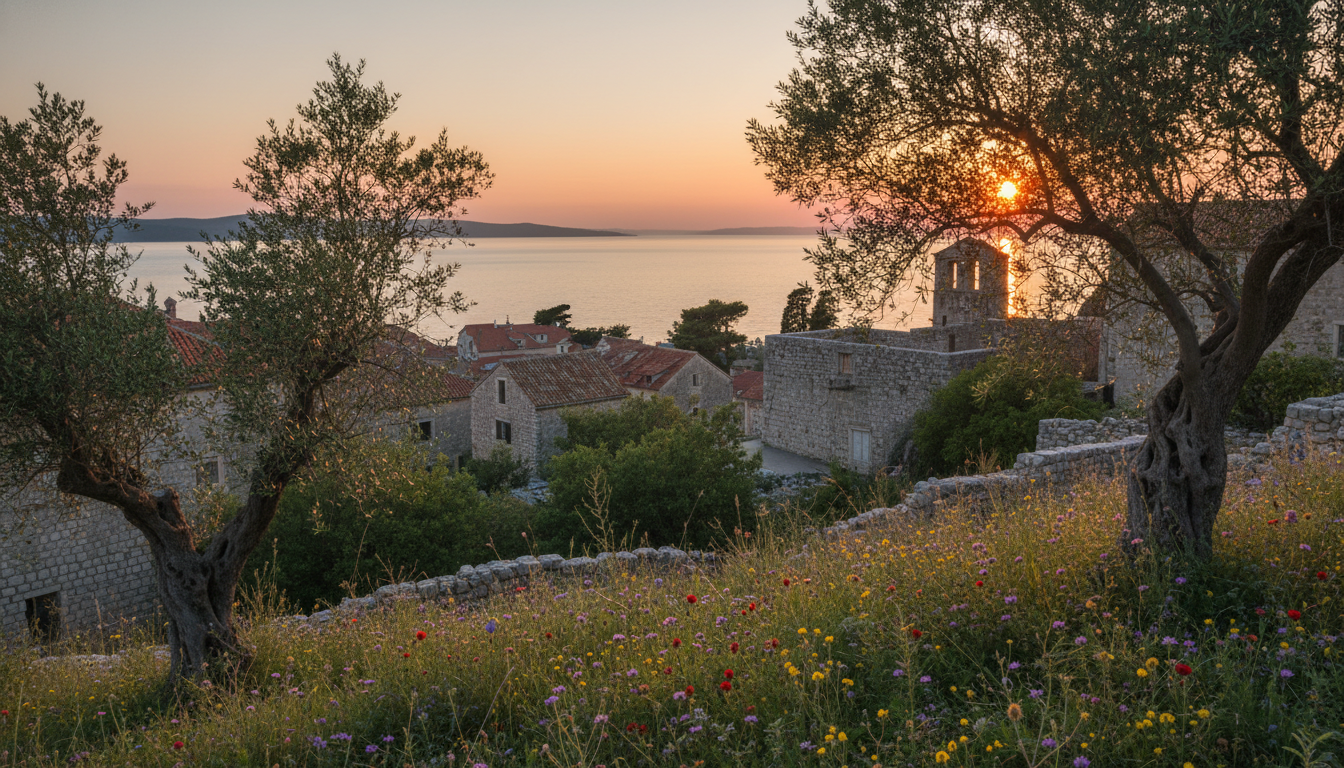
Imagine standing on the edge of the Adriatic, where the land meets the shimmering sea. The geology of this stunning region reveals stories etched in stone, shaped by the relentless waves and ancient forces. Each rock formation and cliff tells a tale of time, inviting you to explore its secrets.
In 2017, Croatia recognized 53 localities for their geological significance, highlighting the natural beauty waiting to be discovered. With high-resolution imagery from Copernicus Sentinel-2 satellites, we can appreciate the intricate details of this landscape. This article serves as your comprehensive map to understanding the unique features of the coastline.
As you delve into this guide, you will uncover how the sea and water interactions have shaped the landscape. From remarkable sites to hidden treasures, prepare for an adventure that connects you with Earth’s history in a way you never thought possible.
Key Takeaways
- Discover a detailed map of the unique geological features along the coastline.
- Learn how the sea has influenced the landscape and created diverse sites.
- Gain insights into the scientific value of the region’s natural formations.
- Transform your visit into a deeper exploration of Earth’s processes.
- Explore significant sites that showcase the geological wonders of this area.
Uncovering the Geology Sibenik Coast
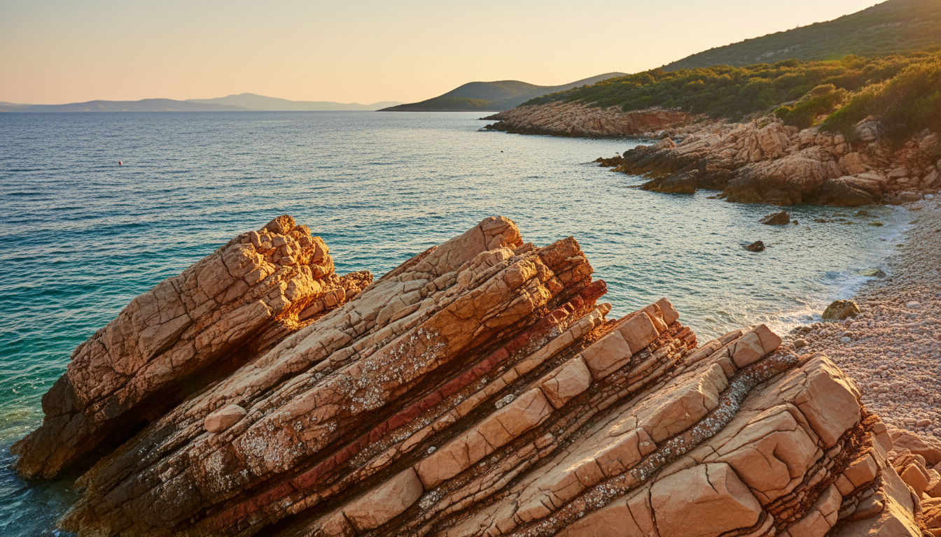
Picture yourself wandering through a landscape shaped by ancient waters and timeless rock formations. The coastal area is defined by massive bioclastic limestone deposits, often reaching 40 metres in thickness. These rocks not only provide a stunning visual backdrop but also serve as a foundation for local architecture.
As you explore, you can observe how the sea has eroded these rocks over time. This erosion reveals distinct features that showcase the complex geological history of the region. Understanding the different types of rock is essential for identifying the unique formations that characterize the shoreline and the surrounding islands.
The Upper Cretaceous period left behind significant layers of limestone. These layers remain some of the most important sites for studying ancient marine environments. As you venture along the coast, notice how the interaction between water and stone creates natural sculptures, both beautiful and scientifically significant.
- Massive bioclastic limestone deposits often reach 40 metres in thickness.
- Sea erosion reveals distinct features showcasing the area’s geological history.
- Understanding rock types helps identify unique coastal formations.
- Upper Cretaceous limestone layers are vital for studying ancient marine life.
- Water and stone interactions create beautiful natural sculptures.
Historical Mining and Quarry Legacy
Delve into the fascinating legacy of mining that has shaped the towns along the shoreline. The historical exploitation of limestone quarries provided essential building materials for the city of Šibenik and other major coastal towns. This rich history is evident in the structures that define the area.
As you explore, you can view remnants of ancient mining techniques. The underground tunnels extend for significant lengths beneath the surface, showcasing the ingenuity of past workers. These sites now serve as important geo-heritage destinations, offering a unique glimpse into the industrial history that shaped the local economy.
- Ancient quarries utilized techniques that left the top surface layer intact.
- Chisel marks from workers provide a tangible connection to the town’s history.
- Many abandoned sites now hold immense cultural value for tourists.
- Every photo captures a piece of the past, from Upper Cretaceous stone to medieval operations.
- At the end of your visit, appreciate how these sites preserve the region’s heritage.
Regional Rock Formations and Sedimentary Deposits
Discover how the interplay of water and sediments has crafted a stunning tapestry of rock formations. The region showcases complex sedimentary deposits that illustrate significant environmental changes over geological time.
These layers reveal how sea levels fluctuated, influencing the accumulation of materials for millions of years. Understanding these sediments is crucial for grasping the area’s unique features and the formation of the underlying limestone.
As you observe these sites, visualize the environmental shifts that transformed a deep marine basin into a vibrant coastal shelf. The interaction of water with these deposits has led to unique geological features, prominently displayed in the exposed cliffs along the shoreline.
Researchers study these formations to track the area’s history, ensuring the scientific value of these sites is preserved for future generations.
The Unique geology sibenik coast Features
The rugged beauty of this coastline reveals fascinating geological features shaped by time and water. The landscape is marked by significant faults that have influenced the development of deep channels and the movement of groundwater.
You can observe how the sea has carved these channels over millions of years, creating a landscape that is constantly shaped by water. The Upper Cretaceous limestone layers are often offset by a major fault, providing a clear view of the tectonic changes that occurred here.
These geological features are essential for understanding the long-term development of the region and the stability of the coastal environment. At the end of your exploration, you will see how the interplay of faults and water has created a diverse and dynamic natural environment.
The accumulation of sediments over millions of years has resulted in the unique rock formations that define the character of the entire coastal area. Each of these sites offers a glimpse into the past, showing how the earth has shifted and settled over vast stretches of time.

Geo-Tourism and Educational Insights
Explore the captivating sites that reveal the region’s rich natural history. You can visit various locations showcasing a wide variety of fossils, including ancient flowers and insects. These remnants provide insights into the mild climate of the past.
The Radboa Museum in the town of Radoboj offers a detailed view of the area’s geological history. Its extensive collection of mineral and fossil samples is a must-see for any earth lover. Educational tourist programs help you navigate the area, providing a map of the most significant places to observe geological features and historical mining remnants.
These sites are perfect for those who want to see how the city and its surroundings have been shaped by both natural and human activity. By exploring these places, you gain a deeper appreciation for the scientific value of the region and the importance of preserving its unique heritage.
Every photo you take of the museum exhibits or the local landscape helps document the variety of geological wonders found throughout the coastal region. The museum collections often feature rare specimens, such as fossilized flowers, essential for learning about the ancient ecosystems of the area.
Hydrogeological Conditions and Karst Landscapes
Beneath the surface of this captivating region lies a hidden world of water and limestone. The intense karstification here causes surface water to vanish into the ground, forming complex underground channels and reservoirs.
The Jaruga, Torak, and Pantan springs drain an area exceeding 1000 square kilometers. This demonstrates the intricate nature of the karst underground, making the study of these springs vital for understanding local water resources.
In the case of major karst springs, the presence of a fault can create barriers that significantly influence groundwater flow. These sites are essential for grasping how water interacts with the surface, revealing much about the area’s unique features.
At the end of your visit, you will appreciate why these areas are protected. They support diverse flora, including local flowers, and are crucial for the region’s ecological balance. Each place you explore offers a unique view of how karstification has shaped this beautiful landscape over countless times.
Regional Conservation and Future Developments
Explore how dedicated efforts are shaping the future of this unique region, blending history with conservation. Community involvement is essential for preserving geological sites, ensuring that the history of mining and stone exploitation is not lost to time.
This article emphasizes the importance of sustainable development, allowing the town and surrounding areas to benefit from geo-tourism while protecting the environment. You can support these efforts by visiting protected sites on the island or in the city, where local groups work to maintain the natural beauty.
Future development plans aim to create a map of geo-heritage locations, making it easier for you to find and appreciate the variety of rock types in the region. There is plenty of room for new initiatives focusing on learning from the past, such as restoring old mining sites for public education and enjoyment.
By protecting these areas, we ensure that the unique features of the coast, from the surface rocks to hidden water sources, remain intact for everyone. The ongoing efforts to preserve these places demonstrate a commitment to the future, where the history of the land is celebrated alongside its natural beauty.
Conclusion
With every step, you’ve uncovered the beauty and complexity of this remarkable region. The landscape serves as a fascinating record of Earth’s history, shaped by the sea and water over millions of years. We hope this article has helped you appreciate the scientific and cultural value of the sites you explored during your journey.
By understanding the unique features of the area, you gain a deeper view of how the town and its surroundings have evolved over time. Protecting these sites ensures that future generations can continue to enjoy the natural beauty, from the rugged rocks to the delicate flowers.
At the end of your trip, you carry with you a new perspective on the natural world and the importance of preserving our shared heritage.